

Ag Services
Drone Spraying,
Spreading & Crop monitoring
- Serving the Okanagan & Interior BC
Professional aerial application for orchards, vineyards, and specialty crops. Certified pilots. Compliant operations. Real results.
Services
Overview
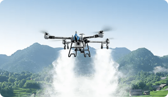
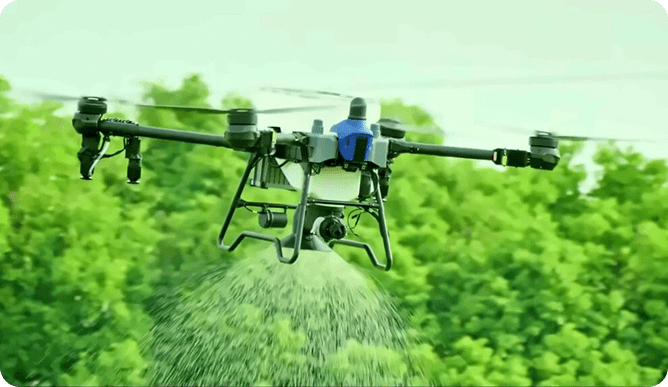
Full Coverage Drone Spraying
for Row Crops, Vineyards & Orchards
Our EA-J70 and EA-J150 drones deliver accurate, consistent spray coverage - even on steep Okanagan slopes and tight orchard rows. Autonomous flight paths, terrain-following, and adjustable droplet sizes (10–500+ microns) mean targeted applications that cut waste and improve outcomes.
What You Get:
- Uniform coverage across rows, slopes, and irregular fields
- Precision droplet control for foliar feeds and permitted crop inputs
- 30–50% reduction in water usage vs. ground rigs
- Zero crop trampling or soil compaction
- 30–60 acres per hour depending on model and conditions
Ideal For:
- Orchards (apple, cherry, pear, peach)
- Vineyards and wine grapes
- Berry crops (blueberries, raspberries, strawberries)
- Row crops and specialty crops
- Steep, wet, or inaccessible terrain
Talk to our professionals.
Granular Spreading
& Seed Broadcasting
Drones aren't just for liquids. With spreader systems up to 85 kg on the EA-J150 and 55 kg on the EA-J70, we deliver even, controlled distribution of granular products across any terrain - including ground that's too wet, steep, or soft for equipment.
Applications:
- Granular fertilizer
- Soil amendments and lime
- Pest control granules
- Beneficial insects
- Seeding - cover crops
Why It works Better Than A Rig
- Even distribution with adjustable spread patterns
- No rutting, wheel tracks, or compaction
- Full access to wet, steep, or soft ground
- Faster turnaround, lower labour cost per acre
- Access to inaccessible terrain
AG Drones apply efficiently in difficult terrain.
Crop health Monitoring - See Problems Before they Cost You.
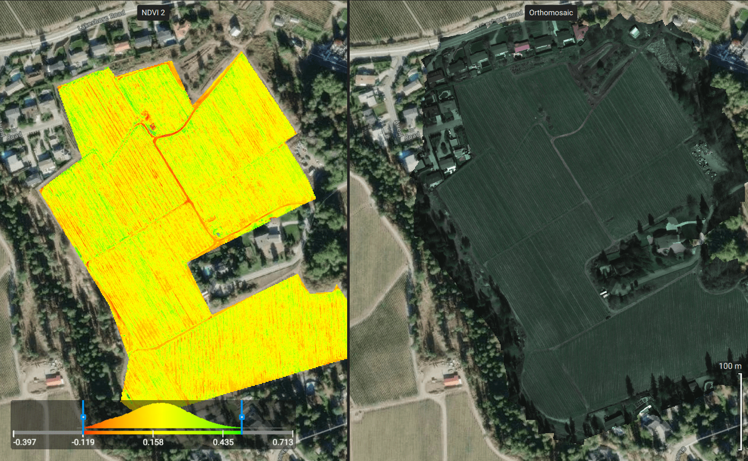
Using RGB and multispectral mapping, we give you a detailed picture of crop performance, plant stress, and field variability throughout the season.
Catch issues early. Target your inputs where they'll have the most impact.
Mapping Capabilities:
- Plant counts and stand analysis
- Yield estimation
- Water, nutrient, and disease stress detection
- Prescription mapping for variable-rate application
- Field inspection and routine monitoring programs
What You Receive:
- High-resolution orthomosaic maps
- NDVI/NDRE vegetation health indices
- Zone maps for variable-rate input application
- Written recommendations based on field data
- Partnership Advantages
For deeper diagnostics, ask about our partnership with AgTek360 - non-destructive in-field leaf tissue analysis providing a 12-point nutrient profile, geo-located for precision spot spraying.
Prescription Mapping - Add Nutrients Where they're need the most.
1. Analyze
Field scouting & crop diagnostics. Drone imagery and field intelligence identify crop stress, nutrient deficiencies, disease pressure and variability
2. Recommend
Agronomic expertise. Our team at agtek360 interprets field data and develops practical recommendation to improve crop performance.
3. Apply
Precision application using the most advanced ag drones on the market for greater accuracy, efficiency and safety.
4. Measure
Monitor results throughout the season using drone imagery and in-field analysis,
5. Optimize
Use result findings to refine decisions to maximize yield potential and improve ROI
Aerial Application Just Got Easier.
Questions & Answers
Liquid nutrients, bio-stimulants, fulvic/humic acids, and products labeled for RPAS use are currently permitted.
Granular fertilizer and seed broadcasting are also permitted.
Herbicides, Pesticides and Fungicides are now allowed under Health Canada’s proposed policy PRO2026-01 is expected to expand this to all aerial-registered products.
Ask us for the latest on what’s approved for your crop and product.
Pricing is based on acreage, product, terrain, and service area. Contact us for a custom quote – most growers see significant savings vs. ground equipment
The EA-J150 covers 40–60 hectares/hour. The EA-J70 covers 50+ acres/hour. Actual rates depend on field shape, terrain, and application rate.
Yes – you supply the product, we supply the expertise and equipment. Through our partners at AgTek360 we can also help source and formulate crop nutrition programs.
Yes. All pilots hold Transport Canada RPAS Advanced Certification and operate under commercial insurance.
For more information on all-things agricultural drones contact us.
Ready to Book a Service or Get a Quote?
Whether it's a single application or a full-season program - we're here. Contact us for a free consultation and honest advice on what will work for your operation.